
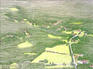
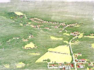
Mill Village -- Existing Conditions Before Development
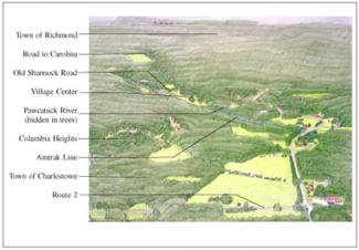
Mill Village - Introduction to the Site
The village of Shannock straddles the Pawcatuck river, which once powered the mills that employed its people. Now the village is quieter, the mills are no longer in operation, and residents go elsewhere to work. It remains a nice place to live, in part because of the rich legacy of buildings, the sense of moving water nearby, and the feeling of community inherent in a place that's a little bit off the beaten track. One of the attractive things about the village is that it's surrounded by hundreds of acres of undeveloped open space --though all of that is zoned for residential development.
Like many mill villages, this one is split between two towns, Richmond and Charlestown, and the presence of a high-speed Amtrak line further complicates the situation. The potential for future commuter rail service, however, holds out some intriguing possibilities. Recent upgrades to the rail line and simultaneous work on roads and bridges has improved the physical structure of the village, it remains to be seen whether new homes and businesses can or should be persuaded to move in.
Shannock was built around the mills and the river; roads and houses came after, giving it the complex, organic quality that always makes mill villages interesting places.
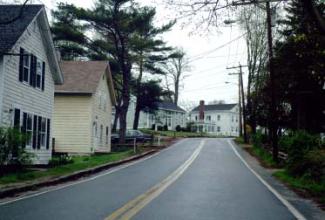
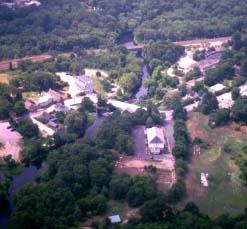
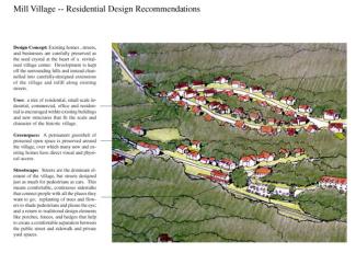
Houses are close together and close to the street in the village; porches, fences, hedges, and changes in elevation help to preserve privacy even in a compact center.
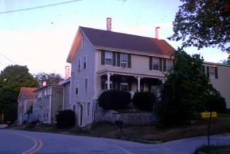
Houses close to the road enclose the space of the street -- when you arrive you know it. Twists and turns in the road divide the street into a series of outdoor rooms.
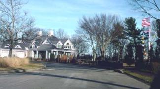
Mill Village -- After Conventional Development
Mill Village -- Conventional Development
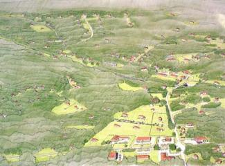
Zoning requirements for half-acre lots and constraints on septic systems and parking make it difficult to develop new residences in the village center. Development continues in the countryside, however, where large parcels with good soils and easy access are subdivided first. On the commercial side the same pressures force businesses to expand outside the village center; most of the activity will be in the highway commercial zone. The cycle of disinvestment in the village center gets worse as people have fewer reasons to be there. The best that can be hoped for is that existing residents will be able to keep up their houses and the village remains a pleasant place to live -- but they will have to work, shop and seek entertainment elsewhere. Meanwhile, historic mill buildings and commercial structures are abandoned and eventually disintegrate.
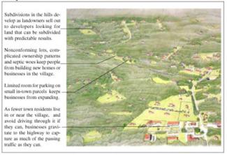
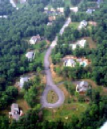
Since it's easier and quicker to develop large parcels outside of older village centers it is little wonder that developers do it; but everyone loses when forests are cut up by house lots.
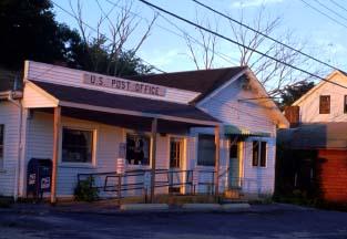
Public facilities are not immune to sprawl pressures; with the need for parking and expansion, officials often seek larger sites. How long will Shannock have its own post office?
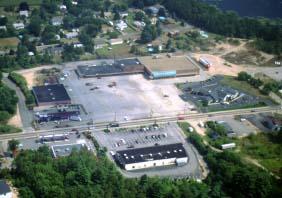
Commercial development in small towns has been dominated by a pattern that maximizes parking and floor area at the expense of visual quality and town character.
Mill Village -- After Creative Development
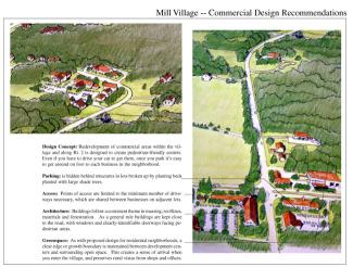
Mill Village -- Implementation Techniques and Examples
Revitalization of the mill village begins with a detailed planning and consensus-building process for the village and its surrounding landscape. Residents would be actively involved in developing a vision for the future of the village wherein they would decide which historic resources within the village or natural landscapes in the surrounding area should be protected. Alternatives for future development would be drawn up and thought through as part of the planning process, which would ideally continue to the point where new streets and building locations are drawn up on a map, at least conceptually, as a clear physical plan for future development.
Once a consensus is reached as to the ideal future for the village, a Planned Village Development District is created, with standards designed to promote adaptive reuse of old buildings and infill of the village core with complementary new structures. Large parcels on the edge of town can still be developed, but clustering is used to ensure that new development will serve as a seamless extension of the existing village. One cluster strategy, conservation subdivision design, is used when the concern is for preserving large contiguous areas of open space in the village greenbelt; flexible design is employed for those parcels where road layout, streetscape and architectural design are paramount.
Regardless of the planning techniques or zoning ordinances designed to implement the village revitalization plan, the hardest part is convincing developers and landowners that compact development in the village is better in the long run for all concerned. Like the familiar argument against clustering in the countryside, people just can't believe that dense development in the village center will produce the same returns as large lot development outside it. Increasingly, however, successful examples of compact, mixed-use development are showing up to counter these worries -- some, like Wickford Point in North Kingstown, are already proving that small lots can bring high prices exactly because of the amenities that living in a village provides.
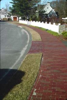
Details like brick sidewalks, stone walls, picket fences, landscaped parks, buried utilities, and recreational amenities are all made possible by the cost savings that come with more compact development. These features create the visual character and quality of life that make up for smaller lots and nearby neighbors, and lots sell for as much as larger lots in a development lacking these amenities.
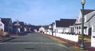
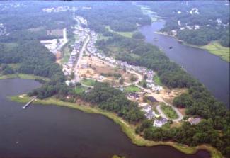
Wickford Point, in North Kingstown, demonstrates the attention to streetscape design and public amenities that keeps market values high even when lots are quite small. In the aerial view (top) the general layout can be seen, with a road looping through several distinct neighborhoods, each with a separate density and character of development. The neighborhoods are linked together by comfortable sidewalks along the streets, and paths through protected open space on the water side. These lead to public parks and water access shared by the residents.