Coastal Pond Seine Survey
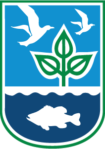
On the water
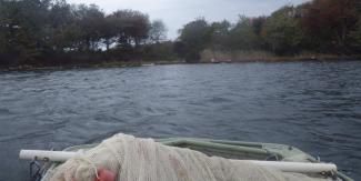
Hauling in the seine
Juvenile Winter Flounder (Pseudopleuronectes americanus)
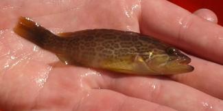
Tropical Fish, Scamp Grouper (Mycteroperca phenax)
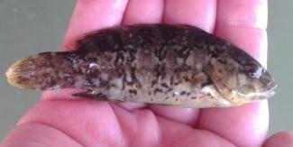
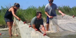
Juvenile Tautog (Tautoga onitis)
Background
The RI Coastal Pond Juvenile Finfish Survey (CPS) began in 1994. The purpose of the survey is to monitor the relative abundance and distribution of the juvenile fish and invertebrates in the Washington County, RI Salt Ponds. The data collected is used in stock assessments, development of Fishery Management Plans, permitting, evaluating changes in juvenile population dynamics, and to characterize and map essential juvenile finish habitat within the ponds.
Survey Design
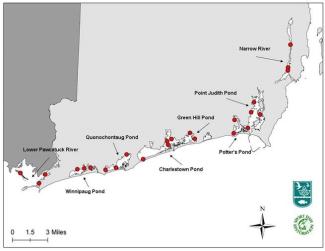
The CPS samples 24 locations in Point Judith, Potters, Green Hill, Ninigret, Quononchotaug, Winnipaug Ponds as well as the Narrow and Pawcatuck Rivers.
Survey Gear
To collect the fish the CPS uses a 130 foot long, 6 foot deep beach seine. The beach seine is comprised of a float line and weighted ground line with ¼ inch mesh.
Sampling Methods
The beach seine is set in a semi-circle, away from the shoreline and back again using 18’ aluminum boat. The net is then hauled toward the beach by hand and the contents emptied into a large water filled bucket. Area swept of the net is calculated to be, on average, 2,112 sq ft.
Physical measurements, such as weather conditions, water temperature, dissolved oxygen, and salinity are taken at each station. Fish are sorted by species, measured, and counted. If more than 20 of a single species are collected, a sub-sample is taken. The sub-sampled is then measured and counted. Fish are released immediately after measurements are taken. Relative abundances of invertebrates and aquatic vegetation are also noted.
Sampling Frequency
All stations are sampled monthly between May and October each year.
Sampling Locations:
For more information about the survey please contact Katie Rodrigue