Forested Tract With Rail Access -- Existing Conditions Before Development
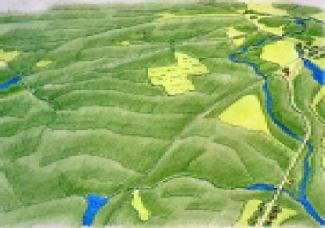
Forested Tract With Rail Access -- Introduction to the Site
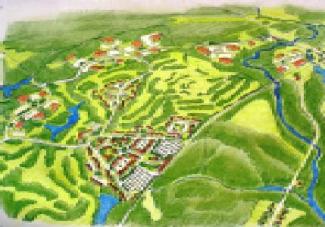
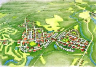
The study area is centered on the so-called United Nuclear Site in Charlestown, and is roughly bounded on the South by Cedar Swamp Brook, Rt. 91on the North, Route 112 to the East, and Kings Factory Rd. to the West. The United Nuclear parcel totals about 1,100 acres, about 350 acres of which is wetlands, 125 acres stream and property buffers, 45 acres former processing facility (off limits to development) and 580 acres buildable upland. Of the buildable portion some 350 acres is rolling, rocky hills covered with oak/hickory forest and 230 acres is alluvial plain, half pine forest and half recent agriculture. Unused since 1982, the site has been the subject of several proposals. While the town of Charlestown was preparing its comprehensive plan in 1990-91, the owners brought forth a proposal for a destination golf resort on the property and, with the support of the State Department of Economic Development successfully argued for a zoning change from Research & Development/Industrial to Planned Development District. A schematic plan of the proposal prepared at that time is the basis of the "conventional development plan" illustrated here.
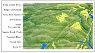
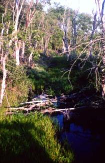
The southern part of the site drains into Indian Cedar Swamp.
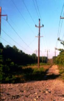
Electic Transmission lines cross the site near its southern edge.
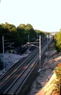
The main Washington-Boston Amtrak line passes right through the study area.
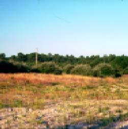
Only a fraction of the site is cleared land, most of which is part of the former United Nuclear processing facility.
Forested Tract With Rail Access -- After Conventional Development
Forested Tract With Rail Access -- Conventional Development
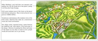
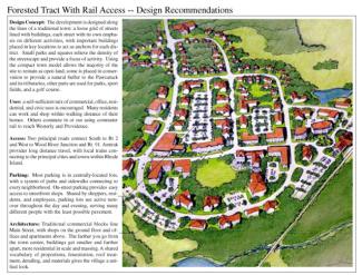
The conventional plan illustrates a common problem with some attempts at using the"new urbanist" development approach: too often it is limited to the addition of a nicely designed center to a development which otherwise is organized along the lines of a traditional office park. That is the case with this scheme, which is based on a proposal put forward for the property in 1992. At its core, the development does contain elements of a real village, with a railroad station, conference center, retail shops, and parking lots. Beyond this center, however, the plan reverts to the familiar office park layout of winding subdivision roads connecting development lots. Most of these are slated for research&development buildings, with some others, adjacent to the golf course, left for condominiums. The result is a development where most uses are too far apart to walk between them, in which the village core becomes little more than a mall and commuter parking lot for the train station.
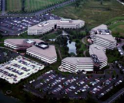
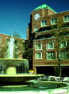
Today's award-winning office park designs provide landscaped courtyards and consistent architecture -- but are often cut off from their surroundings by parking lots.
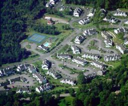
The usual toun-house development lacks a town; makes do with a swimming pool and tennis courts. Attractive, perhaps, but lacking in visual variety or sense of place.
Forested Tract With Rail Access -- After Creative Development
Forested Tract With Rail Access -- Implementation Techniques and Examples
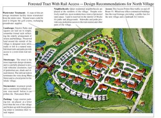
Planning for large vacant parcels should start with analysis of the sites in the context of planning for the neighborhood, district, and town -- for any development on this scale will affect all those other levels. In this case a conceptual masterplan for an area including Wood River Junction and the surrounding road corridors is part of planning process for the United Nuclear Site, which then serves to define future development of the entire neighborhood. Based on this masterplan a Planned Development District (as described in the Model Zoning Ordinances that accompany this Manual) would be established to guide growth. The Planned District would focus on the layout of streets and design of the streetscape as the building block of the village, with particular attention to building setbacks and alignment, and the arrangement of mixed uses within buildings. Design standards would be established, based on the traditional town model of wide sidewalks fronting ground-floor retail, with offices and apartments on upper floors. Parking would either be on-street or hidden from view behind buildings.
A development like this won't happen just by changing the zoning on the property. In order to make the recommended plan work developers must see that the benefits of building a real town outweigh the obvious attraction of golf course subdivisions. The conventional plan takes advantage of the golf course to provide an attractive back yard view for most of the offices and homes in the development. It would probably be very successful, not least of all because the design maximizes the edge between development lots and open space, so that many of the offices or condos would have nice views out over the golf course.
The recommended plan, by contrast, can't offer a golf course view to everyone, so it is necessary to find other amenities to make up for being in the midst of the town: these include being able to walk between home, work, shopping and recreation; tree-shadedstreets that hum with activity throughout the day and evening; parks and playgrounds just down the block, and trails leading to hundreds of acres of undisturbed open space. The other way the village plan can compete is through the cost savings that flow from more efficient use of land, reduction in infrastructure costs, shared parking lots, etc., all of which can be redirected to higher quality of design and materials. This allows developers to recreate the richness of detailing in architecture and lushness of landscaping that is impossible when development is spread thin across the landscape. The result is better results with the same or lower investment, and usually a much nicer place to be.
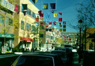
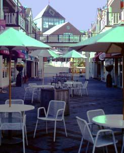
Forrestal Village, in Princeton, New Jersey, while not a true community, is a good example of a well-designed mixed use scheme. Traditional streets with shops and offices (left) lead to an anchoring hotel (bottom left). An interior pedestrian street (bottom right) is lined with two levels of shops and cafes. Porches protect patrons from the elements, while the street itself is open to the sky. Despite these design successes, planners decided not to include residences in the development, which as a result tends to dry up at night. Furthermore, with its location on a highway at the edge of town, surrounded by parking lots, from the outside it looks like a typical mall or office park.